 |
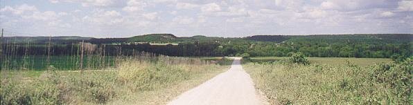
| The view looking down into Village Bend. We travelled the last 3 miles or so down this dusty dirt road only to find that it ends at private property without access to the river. |
|
| The view looking down into Village Bend. We travelled the last 3 miles or so down this dusty dirt road only to find that it ends at private property without access to the river. |
| For our second trip to the Brazos, we cruised further south down Highway 281 out of Mineral Wells, past the Oaks Crossing Road turnoff of the previous week, and down the promising-looking Village Bend Road. At least, it really looked promising on the map. Here, the river makes a lengthy hairpin bend, and my map showed that both sides of the hairpin looked to be easy hiking distance from the road. Alas, after this five mile side trip, we reached the end of the road, as close to the river as we could get, only to find that the area was completely private with not so much as a trail leading to the water. We turned and headed back towards Highway 281. |
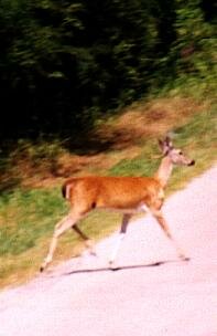 |
Coming back up Village Bend Road to 281 after the disappointment of not getting to the river, we at least had the pleasant experience of having a deer cross the road directly in front of the car. She crossed, stopped at the other side, turned and stared at us for about 20 seconds, then swung around and crossed the road again heading the opposite direction and disappeared into the foilage out of which she had originally appeared. This somewhat confused and indecisive behavior probably explains why so many deer are stuck and killed on Texas roads. |
| Determined to keep looking for another access point, we turned south again on 281 and headed towards a point where the Brazos crosses the highway under a fairly sizeable bridge. No easy access here, either! Continuing south, we picked up Farm-to-Market Road 129 (FM 129) and headed in a northwesterly direction to the little hamlet of Brazos. The map indicated the river flowed very close by. As we hit the little town, we discovered a bridge crossing over what turned out to be Palo Pinto Creek. Stopping the car, we discovered the remnants of an older road which went right down to the stream. Palo Pinto Creek is a somewhat steep-banked, relatively deep little stream (at least where it crosses under FM 129) that eventually flows into the Brazos about a mile downstream from the bridge. Unfortunately, no sandbars or muddy flats along the banks here. The water was muddy green and smelled less than fresh. We shot a few frames of film, then left. I was beginning to get very discouraged. |
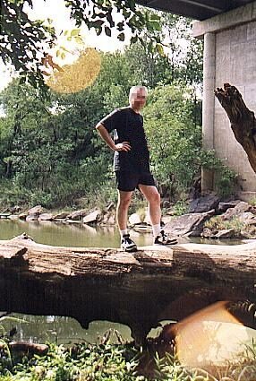  |
| Palo Pinto Creek at Brazos, Texas is a fairly deep but tepid little stream, and I wasn't encouraged to do much more that stand on a large fallen tree and look it over. Behind me in the photo on the left, some sort of large fish was patrolling. You could see his dark shape just under the surface of the greenish, murky water. Palo Pinto Creek flows into the Brazos about a mile or so downstream from the bridge here on FM 129. |
|
Leaving the village of Brazos, we decided to take FM 129 back down to Highway 281, and then 281 south to Interstate 20 and follow the Interstate back east about 10 miles into Parker County. The map showed the river meandering in serpentine fashion through the southwestern corner of Parker County. Most interesting to me, it showed the river flowing through the little village of Dennis, crossing FM 1189.
It was getting late in the afternoon, and this was to be our last stop for the day. If we didn't find an access point here, we would just head home and sulk over dinner! |
(Continues)
![]()