The Brazos River Expedition of July 11, 1999


A view looking southwest from Highway 337 into the Brazos River valley, about 4 miles northwest of Mineral Wells. The river meanders somewhere beyond the bluffs to the right in the middle distance. The 'pond' in the middle of the picture is not a pond at all, but a cattle 'stock tank,' a man-made watering hole.


Palo Pinto County, two counties west of Ft. Worth in north central Texas, is to me where Texas really starts to look like what everybody imagines Texas ought to look like. Low, scenic butte-like hills begin dominating the landscape, and small stands of trees dot the draws and valleys between the hills. Cattle is king here, and one difficulty about exploring the Brazos is that much of the river is fronted by private ranch land, and publicly accessible entry points are few and somewhat far between. Friendly as folks out here are, I am extremely wary about trespassing on private property, so I had to content myself with searching out the public entry areas.

 
The Baker Hotel looms in the distance in this view of M ineral Wells taken from 2 miles south of town off highway 281.

 
Mineral Wells is the county seat of Palo Pinto County. Dominating practically any view of the town is the old Baker Hotel, which during the early years of this century was a mecca for the rich and famous, due to the mineral baths found here. Movie stars, millionaires and such gathered to enjoy the alleged healing powers of the world-famous waters. Now, the old hotel is just a ghost of its former self, crumbling slowly away right on the main drag through town. Although Palo Pinto County is scenic, it has suffered economic decline over the last few decades. For us, that may actually be somewhat fortunate, for it means that prime real estate adjacent to the river hasn't been bought up to be turned into residential subdivisions, unlike next door to the east in Parker County.

 
A vehicle-cut path running parallel to the river at Oaks Crossing. To the extreme right of this photo you can see all the vehicles parked where Oaks Crossing Road literally dead-ends into the river. If you have a truck or off-road vehicle it's a very easy task to drive straight across the river here and continue down the dirt road on the other side, which is known as Pleasant Valley Road, according to my map.

 
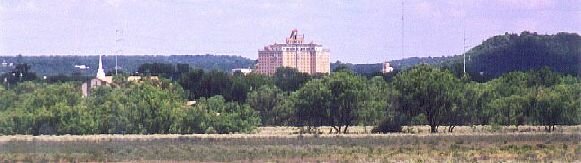
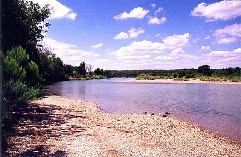
Taking Highway 281 south out of Mineral Wells, you hit Oaks Crossing Road about 3 miles out. You turn west on Oaks Crossing, drive for what seems to be 15 miles, but is actually more like 3 or 4, and coming down a short, blind hill...Bang! There you are! You'll drive right into the Brazos if you're going too fast. No warning signs, no nothing...the road just sashays (Texas talk, there) right up to the ol' river and jumps right on in! Not that you'd drown or anything if you actually did drive into it...in July it's only about 18 inches deep here at the deepest spot.

A favorite swimming and fishing hole with the locals, I had decided to come here, A: because I knew where it was, and B: it was a shallow spot in the river with lots of sandbars that I could easily wade to and explore.


Looking south downstream from Oaks Crossing. The Brazos has plenty of sandbars to explore, and the current was leisurely. Between this spot and that sandbar on the opposite shore directly ahead, the river never got deeper than 18 inches.


Critters of all types abound close to the Brazos.


I don't know what these are, but stay away from them! They hurt like hell! Hehe. Actually, cacti are plentiful even in north Texas, but not so plentiful that they ever proved much of a problem here.


(Continues)