The Brazos River Expedition of April, 2000


The old frontage road bridge, which runs parallel to the modern Interstate 20 bridge. Off camera to the left is a commercial campground which charters out airboat rides. This veiw is looking upstream (due north here), standing just between the two bridges Yes, it's Sandbar City on this stretch of the Brazos...always a good sign!

Just to the left of the left bridge pillar, there's a deep hole where the current cuts into the river bed, just at the spot where we enter and exit the water. The previous year, I had found this hole all by myself and came frighteningly close to drowning while I tried to hold a rather large camera above my head to keep it dry. Fair warning if you visit this spot: watch for these holes near the bridges!

\


When the river level is low, you can see lots of interesting things. In places, the current will sculpt the river bed into some astonishing patterns. This location is another fairly popular access point, and at one or two spots folks can actually drive their vehicles directly down onto the river. I had been here once during the previous year, and noticed that the sandbars closer in to the bridges were absolutely covered with vehicle tire tracks! Apparently, you could manuever a four-wheel-drive truck for a mile or two in either direction, from sandbar to sandbar, without hitting water much deeper than about six to eight inches, if you knew what you were doing and drove in the right places. Ominously, on one sand bar I found a truck's very large outside mirror lying there, and wondered if maybe the rest of the truck was buried in the sand beneath my feet. Most likely, not.

My plans where to journey north from the bridges approximately two miles, to a  major meander in the river called Littlefield Bend. I had no idea what I'd find...my topo maps and satellite pics only showed the usual sandbars and minor features. But I'd learned that you couldn't count on them to show you everything. And some of the funnest places I'd found before had turned out to be on relatively featureless stretches, at least according to the maps.


Hungry? Try a delicious caterpillar! If you're a hardcore survivalist, you'd never have to starve. Bugs, fish, turtles and other critters are easily found here. And deer. Although you can't just walk up and pounce on 'em as easily as you can a nice, fat, juicy caterpillar.


Clambake! Or is it a family reunion? Actually, these guys are long gone. In spots you'll find bunches of clam shells like this. I don't know if they died a natural death and the river current dumps 'em in one place like this, or if this is the result of human intervention. I've never heard of anybody eating these freshwater mollusks, but there are lots of people who catch their meals on the Brazos, and they probably know of lots of wild food sources that I'm unaware of.


Going north, the river had some interesting features. About a mile up, the main channel splits around an island-like sandbar/hillock that had been a feature so long that small trees were growing on it. On a solo journey up here the previous year, I spotted what looked like a young couple parked on this island, and I'm pretty sure the woman was nude. I didn't care to check the young man's attire. They might have just been doing a little au natural sunbathing, but I had the distinct impression that woopie had been going on. I skirted around the island on the east bank of the river, pretending not to notice them, whistling to myself. Away from the public areas, the river can be pretty devoid of people, but I'd always see one or two other intrepid souls on each journey, usually people fishing. Particularly in this area, the airboats can be thick and fast. I don't think I'd choose a sandbar or island in the middle as a site for making woopie. Maybe I'm just a prude, but I'd head into the woods on either side, well away from the stream.  :)


OH MY GOD! QUICKSAND!!! Crossing a sandbar, suddenly the sand sort of wobbled and shifted under me as though I had stepped onto a hidden skateboard under the surface. Within a second or two, I started to settle in. The surface broke into weird little cracks like you see here. I WAS TRAPPED!


Nah...not really. Here I am, a few moments later. Hadn't sunk an iota further in the intervening time! This is typical of what I was finding in one or two spots on just about every sandbar. Shallow quicksand... sometimes areas ten feet across would start getting liquidy and begin undulating. Nature was teasing me, I was certain...


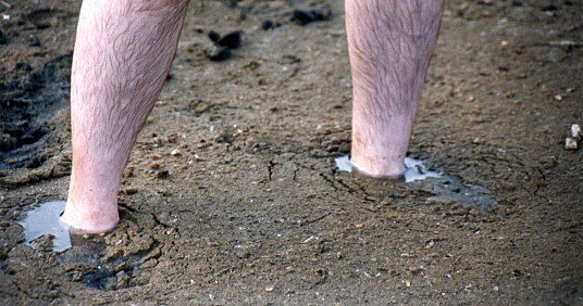
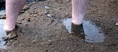
The final mile before our turnaround point, the sand bars become flatter and more numerous. Shallow quicksand everywhere...sometimes mud and clay 'shelves' at the banks, but only a foot deep or less. I was frustrated, but at the same time was having a great time playing Intrepid Explorer and taking photos.

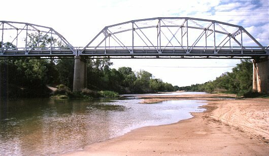
We reached the first turn of Littlefield Bend. A broad, deep-looking creek entered just where the river changed course, from the north. I briefly had an urge to explore it, then thought better of the idea. It didn't look to have any level banks or sandbars, and I figured I might have to wander up it a good quarter mile before the creek got shallow.

At Littlefield Bend there's a bluff on the north side, back from the river a ways, about forty or fifty feet above the water. On this bluff, there were new homes. I was moderately annoyed. Anyone at home there could see us down below quite easily. My companions needed to stop and rest. As they sat, I continued exploring the nearby sandbars, but knowing that if I found anything, the presence of the homes would put a damper on the fun.

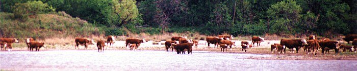
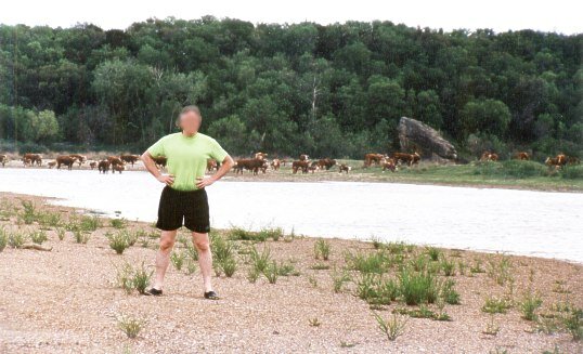
As we rested, they came. The cattle. The inside of Littlefield Bend is relatively low, flat pasture land, and cattle are in the habit of moving en masse down to the water at about the same time each day to drink. Before we could make a move to skirt around them and head back, they had blocked off our return route. Now, I've never had a cow make an aggressive move towards me while on the river, but if you got close, inevitably one or two would start to head in your direction. I suspected that they were just curious to see if you had food or someting of interest...at least, something of interest to a cow. But we didn't, and stayed a good distance away, waiting for them to drink their fill and head home. It took a while. Cattle are, apparently, quite slow drinkers. But then again, why should they hurry? They don't have to be anywhere important. They don't have to get home and cook dinner. Heck, when you're a cow, most of the time you're standing on dinner.


It's a Bovine Standoff! Here I am, looking fearless, but deep inside I'm secretly terrified of the cattle. I had read major magazine articles indicating that cows were often armed and were prone to violence. You'll notice that I'm not facing them. Wouldn't want to provoke 'em. If it were a fair fight, maybe I'd take my chances...but you can see here that I'm clearly outnumberd by about sixty to one.


They left eventually, and so did we. A fun time, but I didn't even manage to get so much as my knees muddy. I was of the opinion that the Brazos was The Safest River in Texas, quicksand-wise.


Map of this expedition

(On to the next expedition!)